Biodiversity in Bolton
Bolton was the focus of a group report for a module in my Master's programme. The project followed two stages: threats to biodiversity and strategies of enhancement. I was tasked with developing the spatial framework for the project.
 My initial outputs involved data sourced from Mapping Greater Manchester to illustrate the threats from natural occurrences such as rainfall and the wider impact of the human activity. It is clear that the areas surrounding the water network pose the greatest risk of flooding, particularly in the east of Bolton. The road and rail network are dense in east Bolton suggesting that human presence is influencing the natural activity in this area.
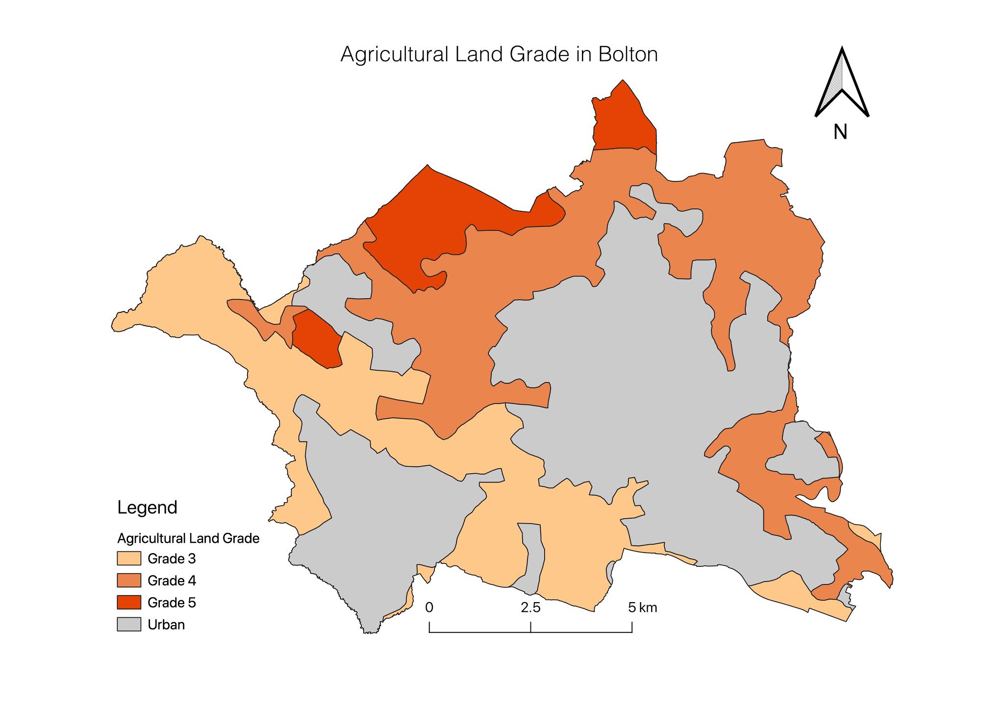
 Identifying the grade of the agricultural land would indicate the quality of the soil throughout the borough. Bolton does not contain any Grade 1 agricultural land (the highest quality) and the condition of the soil decreases towards the north. The presence of Grade 4 and 5 quality soil in Bolton suggests that agricultural operations are limited and that there is a history of threats to biodiversity.
Stage 1.


After a few field visits to the area, we sought to develop a number of strategies which could address these threats and creates opportunities for biodiversity enhancement. A number of key locations were targeted for these strategies and highlighted in the maps below. We argued that these key sites could be connected through a 'green corridor' which would include walking trails and cycle routes.
The maps below include shapefiles from Mapping Greater Manchester, line data of the river network from OS Open Rivers and point data of three key sites. This data is overlaid onto an OpenStreetMap base layer which was set to 80% transparency.
Stage 2.


Comments
Post a Comment